


Geographically, we are blessed that we are living in a country where we are not experiencing earthquakes, typhoons, hurricanes, tsunamis, etc. But there’s one natural disaster that has been haunting us for many years and we still fail to handle it: floods. The floods have resulted in millions of ringgit in damage and countless deaths. But the government is trying something new this time to handle this yearly disaster.
In a news report by the New Straits Times, according to Datuk Seri Dr. Adham Baba, minister of the Ministry of Science, Technologies, and Innovation (MOSTI), he said they will employ technology created by the Malaysian Space Agency (MYSA) to identify flood-prone locations so that early measures may be taken.
Based on a decade’s worth of experience, MYSA would employ satellites to observe data using radar and optical techniques in areas prone to flooding.
MOSTI through MYSA already has data on locations that have been affected by floods before. So with rain measurements and the cooperation of the Malaysian Meteorological Department (Met Malaysia), we can warn the government of flood hotspots when the monsoon sets in so that preparations can be made in advance.
This technology will be presented to the prime minister for his views so that it can be used, adapted and accepted by all ministries and their agencies holistically.
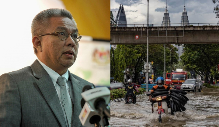
Ministry of Science, Technologies, and Innovation, Minister, Datuk Seri Dr. Adham Baba
In the case of a flood, Dr. Adham said his ministry would also suggest using drones to find victims who have lost communication in isolated areas due to a power outage to expedite their evacuation.
When there is technology and preparation like this, it will help the country identify what forms of volunteering and aid can be channelled before a disaster occurs.
Ministry of Science, Technologies, and Innovation, Minister, Datuk Seri Dr. Adham Baba
Hopefully, this is not just another government project that failed to be implemented and then swept under the rug.